The Mereenie Loop permit is not a tourist pass; it is a legal contract required for transit through privately-owned Aboriginal land.
- Compliance is mandatory and non-negotiable. It acknowledges the authority and spiritual responsibility of the Traditional Owners.
- Driving the route requires a high-clearance 4WD vehicle due to severe corrugations and potential washouts. 2WD vehicles are not suitable.
Recommendation: Secure your permit before departure and prepare your vehicle and supplies based on the understanding that you are a guest on sovereign land with limited services.
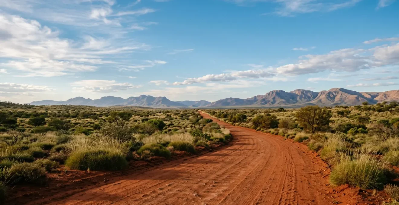
Many 4WD enthusiasts see the Mereenie Loop as a simple shortcut, a dusty line on a map connecting the wonders of Kings Canyon to the West MacDonnell Ranges. The primary concern often revolves around road conditions and fuel stops. While these are valid practicalities, this focus misses the most fundamental aspect of the journey. This is not public land. The track, officially known as the Mereenie Loop Road, traverses Aboriginal Land Trusts, which are private property managed by Traditional Owners.
The common advice is simply to « buy a permit. » But this transactional view fails to capture the significance of the document. It is not a fee for access in the way a national park pass is. It is a formal, legal instrument of permission. Understanding this distinction is the key to a successful and respectful journey. The permit system is an expression of sovereignty and a mechanism for Traditional Owners to manage their land and fulfil their cultural obligations.
This guide shifts the perspective from that of a tourist to that of a respectful visitor. We will address the common practical questions—tyre pressures, fuel, camping—but frame them within the proper legal and cultural context. This is not about what you are allowed to take from the experience, but what you are required to give in terms of respect, preparation, and compliance. By understanding the ‘why’ behind the rules, you will be better equipped to handle the ‘how’ of the journey safely and responsibly.
To ensure you are fully prepared for this unique journey, this article breaks down the essential legal, mechanical, and cultural requirements. The following sections will guide you through each critical aspect of your trip planning, from legal compliance to personal survival.
Summary: Your Complete Guide to the Mereenie Loop
- Entering Aboriginal Land: When Do You Need a Permit to Drive Through?
- 2WD vs 4WD: Can You Really Drive the Mereenie Loop in a Campervan?
- Tyre Pressure for Corrugations: What PSI Prevents Blowouts on the Loop?
- Fuel Prices at Kings Creek Station: How Much Cash Should You Carry?
- Gosse Bluff (Tnorala): Why Can’t You Enter the Crater Rim?
- Bush Camping vs Designated Sites: Where Are You Actually Allowed to Sleep?
- Red Dust Ingress: How to Seal Your Caravan Vents Properly?
- Surviving the Arid Zone: Why 5 Litres of Water Per Day Is the Minimum?
Entering Aboriginal Land: When Do You Need a Permit to Drive Through?
Let us be unequivocal: a permit is required for the simple act of driving on the Mereenie Loop Road. This is not optional, nor is it a recommendation. It is a legal requirement for transit. The moment your vehicle leaves the sealed tarmac of the Lasseter Highway or Larapinta Drive to join the unsealed Mereenie Loop Road, you are entering private Aboriginal land. Your presence is conditional upon holding a valid transit permit. This is a matter of jurisdiction.
The permit system is not designed to generate revenue but to manage access and ensure visitors understand their obligations. As the Central Land Council (CLC), the governing body, explains, this system is fundamental to cultural and environmental protection. As they state in their official guidelines:
The permit system complements Aboriginal spiritual responsibilities for the land, and protects the environment, Aboriginal sacred sites and Aboriginal cultural and intellectual property.
– Central Land Council, CLC Permits FAQ – Why Permits Are Required
The permit is therefore your formal agreement to abide by the rules set by the Traditional Owners. Fortunately, obtaining this permit is a straightforward process, designed for compliance. Multiple outlets are authorised to issue them, though costs and convenience vary. You must acquire your permit *before* entering the unsealed road section. Do not assume you can purchase one midway.
The following table provides a clear comparison of your options for securing this essential legal document. Note that obtaining it from the CLC office in Alice Springs is free, reinforcing that this is about permission, not profit.
| Purchase Location | Cost | Convenience Rating | Opening Hours | Additional Services |
|---|---|---|---|---|
| CLC Office, Alice Springs (27 Stuart Hwy) | Free | ★★★★ | Business hours only (closes 5pm) | Full permit information, maps included |
| Tourism Central Australia, Alice Springs | $5 | ★★★★★ | Extended hours | Travel advice available |
| Glen Helen Resort | $5 | ★★★★ | Daily during resort hours | Fuel, accommodation, meals |
| Hermannsburg (Ntaria) Store | $10 | ★★★ | Store hours vary | Basic supplies only |
| Kings Creek Station | $5 | ★★★ | Daily | Fuel, camping, meals |
| Kings Canyon Resort | $5.50 | ★★★ | Reception hours | Fuel, accommodation |
2WD vs 4WD: Can You Really Drive the Mereenie Loop in a Campervan?
The question of vehicle suitability is not a matter of opinion or adventurous spirit; it is a matter of mechanical capability and safety. The official and unequivocal answer is that this route requires a high-clearance 4WD vehicle. Attempting the journey in a standard 2WD car, campervan, or any vehicle not designed for severe unsealed conditions is prohibited by rental agreements and is exceptionally unwise.
While some sections may appear deceptively smooth after recent grading, the road’s condition can deteriorate rapidly. The defining characteristic of the Mereenie Loop is its relentless corrugations. These harmonic ripples in the road surface can shake a vehicle apart. A 4WD with appropriate tyre pressures can « float » over them at a certain speed, but a 2WD vehicle lacks the suspension, drivetrain, and structural integrity to cope. Beyond corrugations, you will likely encounter soft sand patches, sharp rocks, and potential washouts, especially after rain.
The viability of passage is also heavily dependent on the season. Conditions change drastically between the dry winter months and the wet summer. The matrix below outlines what to expect, making it clear that there is no season where a 2WD is a viable or safe option. It is crucial to check the official NT Road Report website before departure, as the road can be closed with no notice due to weather events.
This table, based on information from decades of experience from local tour operators, illustrates the stark reality of the road conditions you must be prepared for.
| Season | Period | Road Surface Condition | 2WD Viability | 4WD Requirements | Main Hazards |
|---|---|---|---|---|---|
| Dry Season | May – October | Deep corrugations, heavy dust, firm base | Not recommended (rental contracts forbid) | Recommended; high clearance essential | Severe corrugations, tyre damage, dust ingress |
| Wet Season | November – April | Potential washouts, slick mud, road closures | Not viable (dangerous + prohibited) | Mandatory; may still be impassable | Flash flooding, bog risk, extended closures |
| Post-Grading | Variable (check Road Report NT) | Smooth, recently maintained | Still prohibited by rental agreements | Easier conditions but permit still requires 4WD | Conditions deteriorate rapidly with traffic |
Tyre Pressure for Corrugations: What PSI Prevents Blowouts on the Loop?
Once you are on the unsealed sections of the Mereenie Loop, your single most important safety and comfort factor is correct tyre pressure. Driving on corrugations with road-rated pressures is a guaranteed recipe for a miserable ride, potential vehicle damage, and an increased risk of tyre failure. High pressures cause the tyre to bounce from the peak of one corrugation to the next, jarring the vehicle and its occupants. Lowering the pressure allows the tyre to deform and absorb the bumps, creating a much smoother ride and significantly improving traction.
The general rule for outback travel is to reduce pressure to increase the « footprint » of the tyre. For severe corrugations, a significant reduction is necessary. According to 4WD experts, a good starting point is a 30% air reduction from your vehicle’s standard cold road pressures. For example, if your placard recommends 38 PSI for sealed roads, a starting point for the Loop would be around 26-28 PSI. However, this is not a « set and forget » figure. It is a dynamic process.
Lower pressures generate more heat due to sidewall flexing, so you must balance pressure with speed. Driving too fast on low pressures can lead to a catastrophic blowout. The goal is to find the « harmonic speed »—often between 70-80 km/h—where your vehicle feels like it is floating across the tops of the corrugations. You must also carry a reliable pressure gauge and a compressor to reinflate your tyres once you return to the bitumen. Failing to do so is extremely dangerous and will cause rapid tyre wear and handling issues at high speed.
Follow this adjustment strategy for a safer journey:
- Initial Reduction: Start with the ’20 percent rule’. Reduce your vehicle’s placard pressure by 20% as a baseline for dirt roads. For the severe corrugations of the Loop, be prepared to go lower.
- Temperature Monitoring: During rest stops, carefully feel your tyres. If they are too hot to touch comfortably, the pressure is too low for your speed. Reduce speed or add a few PSI.
- Find the Float: Adjust your speed (typically between 70-80 km/h) to find the point where the vehicle ‘glides’ over the corrugations instead of crashing into each one.
- Balance Speed and Pressure: Remember the trade-off. Lower pressures necessitate slower speeds to prevent overheating from excessive tyre flexing.
- Morning Check: Always check and adjust pressures when the tyres are cold. A hot tyre can read 4-6 PSI higher, giving you a false sense of security.
Fuel Prices at Kings Creek Station: How Much Cash Should You Carry?
Logistical planning is a pillar of safe outback travel. On the Mereenie Loop, this primarily concerns fuel. There are no fuel stations on the unsealed portion of the road itself. Your refuelling points are at the beginning and end of the loop: Glen Helen, Hermannsburg, Kings Creek Station, and Kings Canyon Resort. You must have enough fuel to safely travel the approximately 332km between Alice Springs and Kings Canyon, plus a significant safety buffer.
The price of fuel at these remote roadhouses is significantly higher than in Alice Springs—expect to pay two to three times the city price. This is not price gouging; it is the economic reality of transporting fuel hundreds of kilometres into the desert. Furthermore, electronic payment systems in remote areas can be unreliable. It is an operational necessity to carry a substantial amount of cash as a contingency.
A breakdown, a wrong turn, or an unexpected road closure could dramatically increase your fuel consumption. The « rule of thirds » is the minimum standard for remote fuel planning: one-third of your tank to get to your destination, one-third to get back, and one-third as an emergency reserve. For a one-way trip like the Mereenie Loop, this translates to carrying enough fuel for 1.5 times the expected distance. Do not depart from Alice Springs or Kings Canyon without a full tank and, if possible, full jerry cans.
A cash buffer for one full tank of fuel at a premium price, plus funds for emergency supplies or a tow, is a sensible precaution. This could easily amount to several hundred dollars.
Action Plan: Your Fuel Contingency Audit
- Points of Contact: List all potential refuelling points on your map (Alice Springs, Glen Helen, Hermannsburg, Kings Creek, Kings Canyon). Note their operating hours.
- Collecte: Calculate your vehicle’s total fuel capacity (main tank + jerry cans) and its average fuel consumption on unsealed roads (this is higher than on tarmac).
- Cohérence: Apply the « Rule of Thirds » to your route. Is one-third of your capacity sufficient for your planned leg, with a one-third buffer remaining? The 332km Mereenie Loop section requires careful calculation.
- Mémorabilité/émotion: Budget for remote pricing. Calculate the cost of a full tank at an estimated $2.80-$2.90/L. Does this figure surprise you? It shouldn’t. This is the reality.
- Plan d’intégration: Determine your cash contingency. A minimum of one full tank’s cost plus $150 for emergencies is a prudent baseline. Ensure this amount is physically on your person before you leave.
Gosse Bluff (Tnorala): Why Can’t You Enter the Crater Rim?
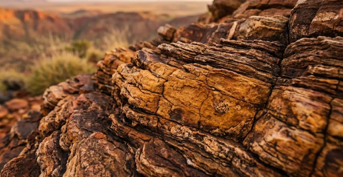
Approximately 55km into the Mereenie Loop from the east, you will encounter Tnorala (Gosse Bluff). To a geologist, it is one of the most significant impact craters on Earth, formed by a comet or asteroid strike 142 million years ago. But to its Traditional Owners, the Western Arrernte people, it is a sacred site of profound cultural importance. Understanding this is central to your journey.
Your permit allows you to visit the designated viewing areas and walk the short track inside the crater floor. It does not, under any circumstances, grant you permission to climb, walk on, or otherwise enter the crater rim. The signs restricting access are not suggestions; they are legal and cultural directives that must be obeyed without question. The reason is rooted in the creation story, or Tjukurpa.
This is a place of immense power and significance, and the story of its creation explains why the rim is off-limits. The Western Arrernte Traditional Owners share this story to help visitors understand the land’s importance:
According to Aboriginal belief, Tnorala was formed in the creation time, when a group of women danced across the sky as the Milky Way. During this dance, a mother put her baby aside, resting in its wooden baby-carrier (tarne). The carrier toppled over the edge of the dancing area and crashed to earth where it was transformed into the circular rock walls of Tnorala.
– Western Arrernte Traditional Owners, Tnorala Conservation Reserve Official Documentation
The crater walls are the fallen baby carrier, a sacred object. To climb them would be an act of profound disrespect, akin to desecrating a high altar in a cathedral. The site is a registered sacred site, and its protection is a shared responsibility.
Co-Management Success at Tnorala Conservation Reserve
Tnorala is a powerful example of successful joint management. The Western Arrernte Aboriginal Corporation works directly with NT Parks and Wildlife to balance visitor access with cultural protection. This model, outlined in the official park management plan, allows visitors to experience the awe of the location from designated areas while ensuring sacred zones remain undisturbed. By respecting the signage, you are actively participating in this successful co-management model and upholding the authority of the Traditional Owners.
Bush Camping vs Designated Sites: Where Are You Actually Allowed to Sleep?
The freedom of the outback often evokes images of pulling over and making camp wherever you please. This is a dangerous misconception on the Mereenie Loop. Your transit permit is exactly that: a permit for transit. It is not a permit to camp. Unauthorised « bush camping » anywhere along the road is strictly prohibited and constitutes trespassing on private Aboriginal land.
The Central Land Council is explicit on this matter. Their guidelines state clearly that camping is forbidden along the road. This rule is in place to protect the fragile environment, safeguard cultural sites that may not be obvious to an untrained eye, and respect the privacy of the Traditional Owners. The only places you are legally permitted to camp are in designated commercial campgrounds, such as those at Glen Helen, Kings Creek Station, or Kings Canyon Resort. You must plan your journey to ensure you can reach one of these sites before nightfall.
Ignoring this rule is not a minor infraction. It is a serious sign of disrespect and carries legal consequences. As the Central Land Council website states, unauthorised entry or camping on Aboriginal land can result in significant penalties. Depending on the specific circumstances, you can face fines of up to $1,000 or more for failing to comply. The isolation of the track is not an invitation to break the rules; it is all the more reason to follow them, as your impact, both environmental and cultural, is magnified in this delicate landscape.
Camping along the Mereenie Loop Road is not permitted, making this road unsuitable to transit by bicycle.
– Central Land Council, CLC Permits Official Guidelines
The logic is simple: if it is not a designated, signposted campground, you do not have permission to be there overnight. Plan your itinerary accordingly. This is a non-negotiable part of your legal and cultural obligation as a visitor.
Red Dust Ingress: How to Seal Your Caravan Vents Properly?
The red dust of Central Australia is legendary. It is finer than talcum powder and has an almost supernatural ability to penetrate any and every seal on a vehicle. For those towing a caravan or camper trailer, preventing dust ingress is a major battle. Arriving at your destination to find a thick layer of red powder over every surface inside your van is a frustrating and entirely preventable experience.
The primary culprits for dust entry are vents—fridge vents, roof vents, and wall vents. While driving, the motion of your vehicle creates a negative pressure zone, actively sucking dust in through any unsealed gap. Simply closing them is often not enough. A proactive approach to sealing is required before you hit the unsealed road.
A common and effective method is to use low-pressure vent covers or purpose-made dust suppression systems. These often involve a filtered fan that lightly pressurises the inside of the caravan, creating positive pressure that actively pushes air out through the gaps, preventing dust from entering. For a lower-tech solution, many travellers use cut-to-size foam filter material (like that used in air conditioners) or dense foam strips to block off external vents during transit. It is crucial, however, to remove these covers when you stop and need to run appliances like a gas fridge, which require ventilation for safety.
Door and window seals are another weak point. Ensure they are clean and in good condition. Some travellers add a secondary layer of foam weather-stripping tape around hatches and doors. Covering gaps around water filler pipes and electrical inlets with heavy-duty tape can also make a significant difference. A few hours of preparation before leaving Alice Springs or Kings Canyon can save you many hours of cleaning later.
Key Takeaways
- A permit is a legal necessity, not a tourist ticket. It signifies a contract of respect with Traditional Owners.
- The route is strictly for high-clearance 4WD vehicles. Corrugations and road conditions make 2WD transit unsafe and prohibited.
- Respect for cultural sites like Tnorala and adherence to rules like « no bush camping » are non-negotiable parts of the permit agreement.
Surviving the Arid Zone: Why 5 Litres of Water Per Day Is the Minimum?
The final and most critical element of your preparation is personal survival. The Mereenie Loop travels through an arid zone where temperatures can be extreme and help can be hours or even days away. Your most precious resource is not fuel, but water. Dehydration is a rapid and serious threat in this environment, and underestimating your needs can have fatal consequences.
The standard recommendation of five litres of water, per person, per day is an absolute minimum for drinking. This figure accounts for the increased perspiration in a hot, dry climate, even if you are sitting in an air-conditioned vehicle. In the event of a breakdown where you are forced to wait outside your vehicle, your water consumption will increase dramatically. This five-litre rule does not include water needed for cooking or washing.
Your vehicle should be carrying enough water for the duration of your trip, plus a significant emergency reserve. A safety margin of at least two extra days is prudent. For two people on a three-day trip, this means a minimum calculation of (5L x 2 people x 3 days) + (5L x 2 people x 2 emergency days) = 50 litres of drinking water. On top of this, a separate 20-litre container of water should be carried exclusively for the vehicle in case of radiator issues.
Potable water is only available at the established nodes of Alice Springs, Glen Helen, Hermannsburg, Kings Creek Station, and Kings Canyon. Do not assume you will find water anywhere in between. According to local safety guidelines, you must be self-sufficient. Your life may depend on it.
- Personal Drinking Water: Calculate (5 litres × number of people × number of days) as your baseline.
- Vehicle Emergency Reserve: Add a dedicated minimum of 20 litres for the vehicle.
- Cooking & Hygiene: Factor in an additional 2-3 litres per person, per day if you are camping.
- Safety Margin: Add a 20% buffer to your total for unexpected delays.
- Map Refill Points: Know exactly where your next reliable water source is before you depart from your current one.
Now that you understand the legal, mechanical, and survival requirements, your next step is to plan your journey with the respect and preparation this unique landscape deserves. Travel safely, and travel respectfully.